-
Title
-
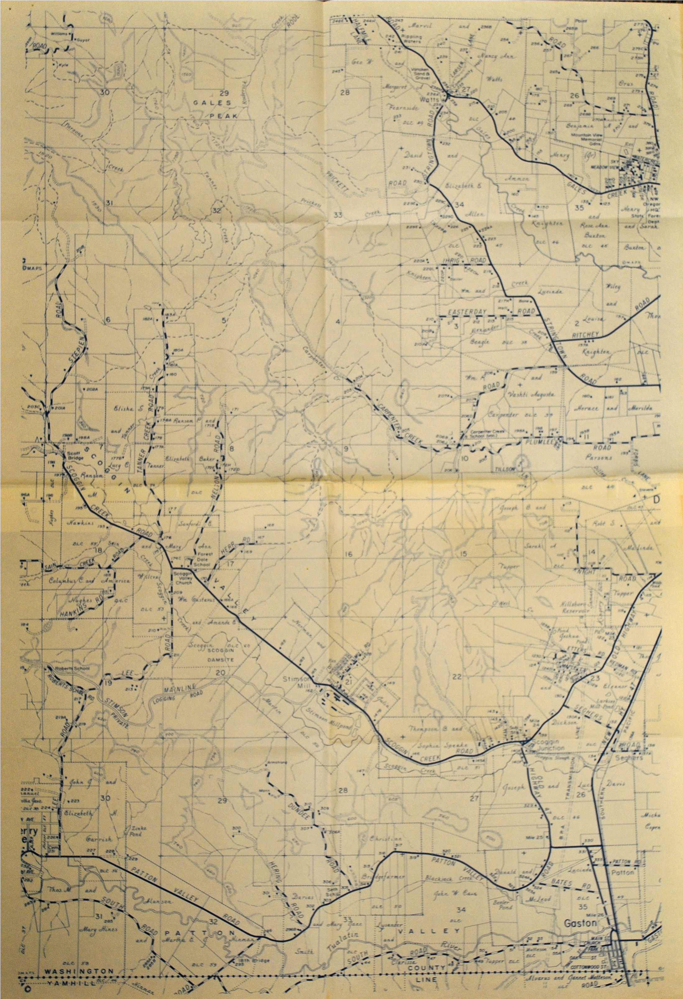
Scoggins Valley map 5
-
Description
-
Map of the area due to be effected by the Scoggins Valley Dam project. The map shows the surrounding towns, the Stimson Mill, and the land owners at the time. The map also shows the original Donation Land Claim plots. Donation Land Claims were taken by early settlers in Oregon as part of a government program that began in 1850 and sought to bring settlers to the western territories. Single men were granted 320 acres of land, while married couples could claim 640 (the later, arguably more famous, Homestead Act of 1862, granted claimants 160 acres of land).
-
Date
-
circa 1970s
-
Identifier
-
RG_5_12_map5.jpg
-
Type
-
Text
-
Still Image
-
Rights
-
http://rightsstatements.org/vocab/CNE/1.0/