-
Title
-
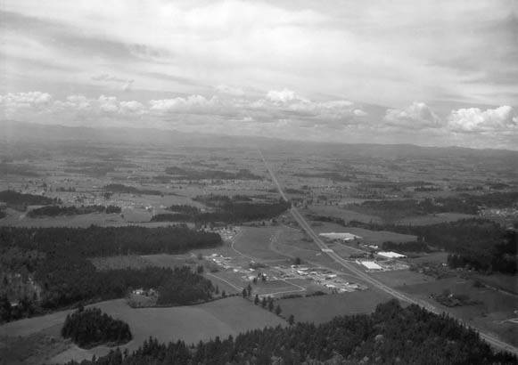
Aerial view of U.S. Highway 26, also known as Sunset Highway
-
Description
-
The view looks west towards Cedar Hills, at what will eventually connect to Highway 217. The Peterkort greenhouses are to the right.
-
Identifier
-
BEApic_002
-
Rights
-
Online access to this image is for research and educational purposes only. To inquire about permissions, order a reproduction, or for more information, please contact the Beaverton Historical Society at info@historicbeaverton.org.
-
http://rightsstatements.org/vocab/CNE/1.0/
-
Date Created
-
1948
-
Date
-
1948
-
Source
-
City of Beaverton
-
Type
-
Still Image