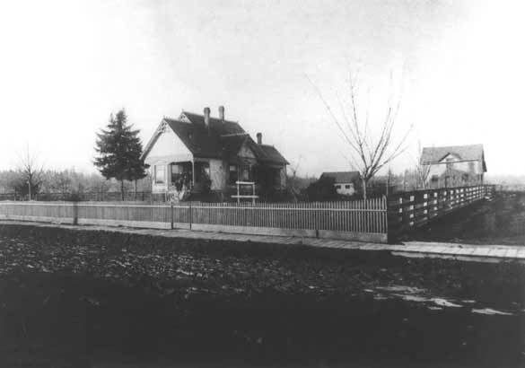
A two or three story home with three chimneys is in the foreground, surrounded by a wooden fence. An outbuilding and an unidentified home are the right of center. Two unpaved streets are visible. The Cady home was at the corner of 7th and Angel Streets.
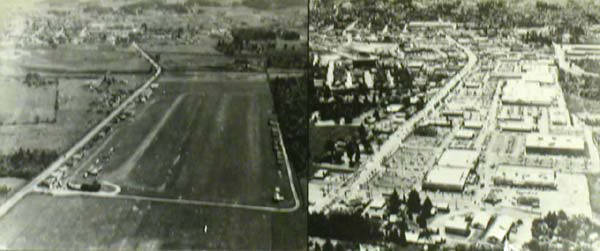
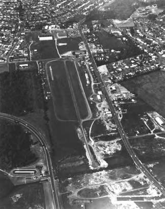
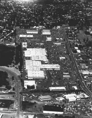
The view of Bernard Airport at the left was taken in the 1930s. The mall photo was taken in the late 1980s. Charles Bernard sold his property to commercial developers in 1969 when property taxes increased and hangar rents no longer covered the assessments. He drove his own bulldozer to raze the hangars. The mall is now known as Cedar Hills Crossing.
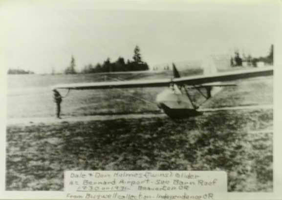
The handmade glider of twins Dale and Don Holmes makes a gentle landing at Bernard Airport in 1930 or 31. Note the roof of Bernard's barn located just north of Walker Road in the photograph. The photo is from the Buswell Collection.
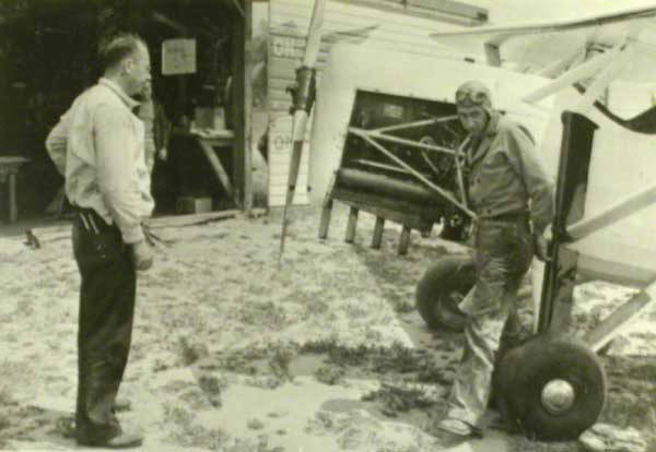
George Yates is with student pilot Morrie Gilbert, a Portland, Oregon businessman. Yates' pilot license #549 was issued in 1930 and signed by Orville Wright.
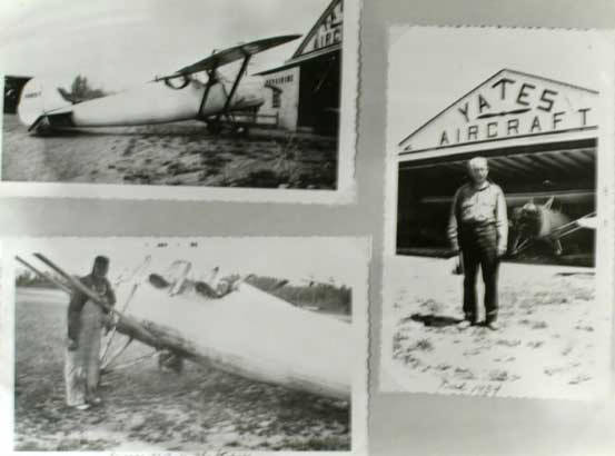
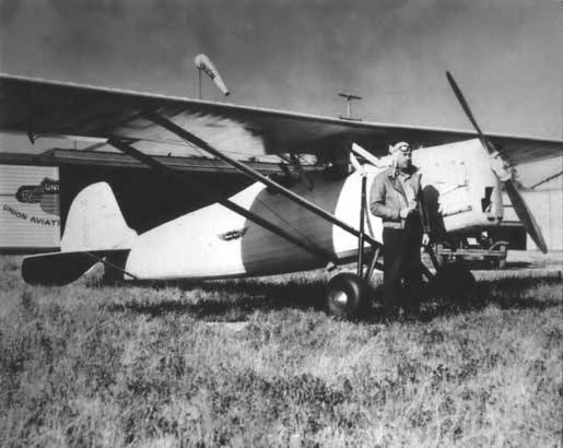
Top left: George Yates built the Stiper airplane for Beaverton businessman Elmer Stipe. Bottom left: George Yates and the Stiper. Right: Charles Bernard stands in front of the Yates Aircraft building. The plane had two seats and a parasol wing. It eventually flew 4,000 hours, carrying passengers.
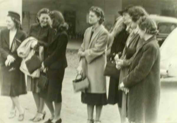
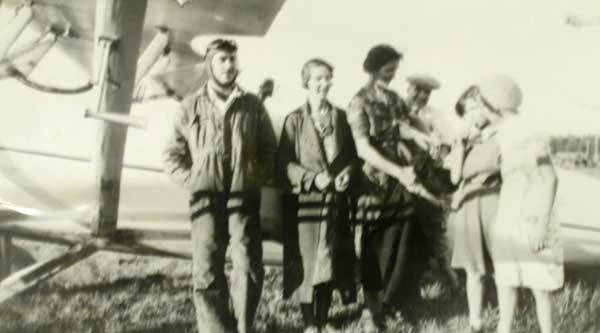
Cedar Hills residents visit George Yates at far left. To his right are Anne Holboke, Sophie and George Moshofsky, and their children. (Names unknown.) The photo was taken at Bernard Airport.
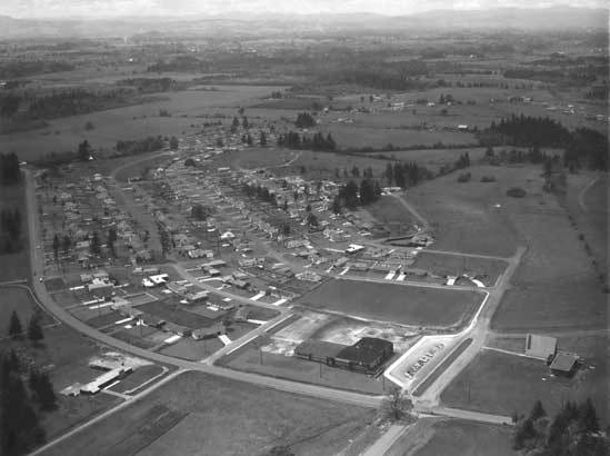
Southwest Beaverton -Hillsdale Highway extends from left to right at bottom and is intersected by SW Laurelwood Avenue. The vacant land at lower left has been identified as the future site of Zupan's Market. SW Crestwood Drive is at the center; SW Whitepine Lane is at its left (west) and SW 83rd Avenue is at its right. The view looks northwest.
Bernard Mall, later known as Beaverton Mall, is now called Cedar Hills Crossing. Cedar Hills Boulevard paralells the shopping center. The view looks north.
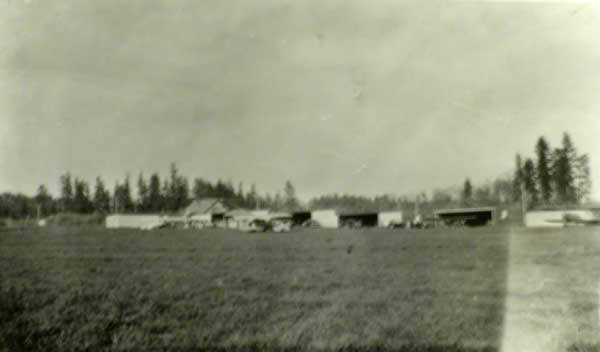
This is one of the earliest photos of Bernard Airport, which began operations about 1931. Cedar Street, now Cedar Hills Boulevard, parallels the airport on the right side.
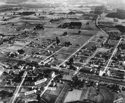
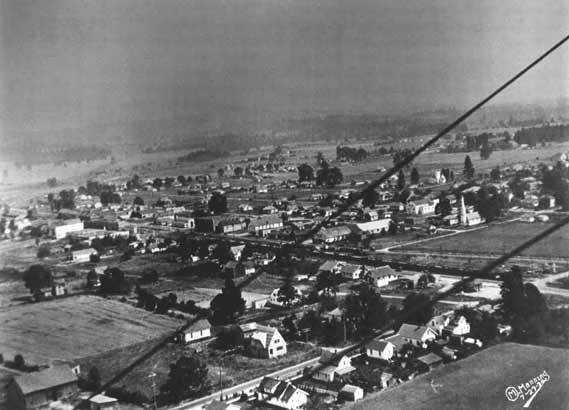
The bandstand was moved from Broadway Street when the Fisher Building was constructed. To the right of the bandstand is a small structure - City Hall. The large white wood building with the stairway is Ray Morse Hall. A little down from the center to the right is the two-story Cady Building on SW Farmington Avenue. SW Watson Avenue extends north to south, angling to the top of the photo. The view looks to the south.
SW Farmington Road bisects the photo left to right. A little left of center is the two-story brick Cady building, facing Farmington. Cedar Hills Boulevard intersects in the foreground. next to the old bank of Left of that is Broadway, with the long old brick building.
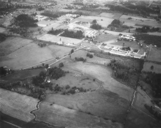
View looking southeast along the railroad tracks toward downtown Beaverton in upper right. Bernard Airfield is at upper left. Directly below at right is the St. Mary's electrical substation just west of Beaverton with high tension wires running north-south. The big open field in upper left is the site of the future Tektronix.
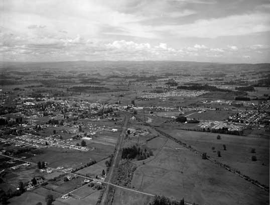
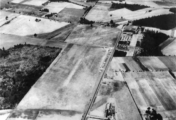
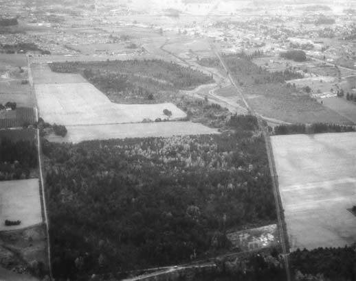
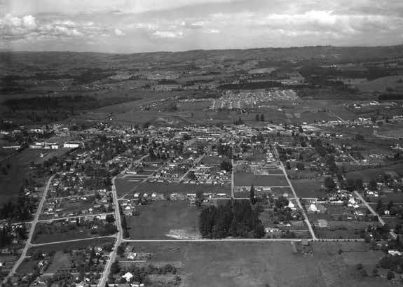
SW Hall Boulevard extends from left to right and is intersected by SW Scholls Ferry Road. The Fanno Farmhouse can be seen at lower left. The community of Progress is visible adjacent to the grove of trees at center right. The View-Master water tower can be seen.
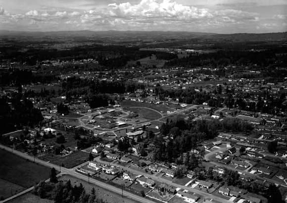
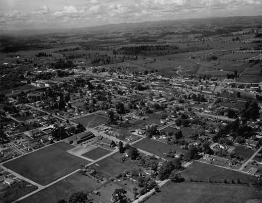
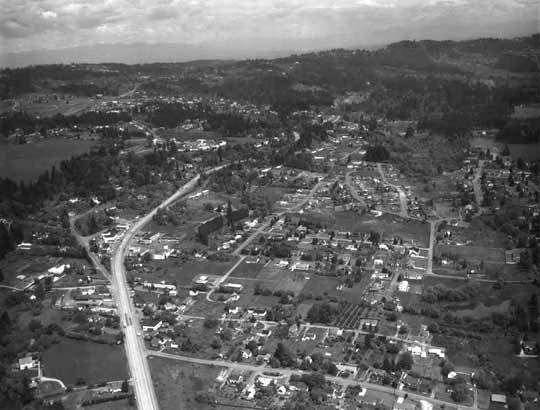
The view looks north. Beaverton High School is at far left, SW 12th Street is at bottom center from left to right, Bernard's Airfield is at upper left, and the future site of Beaverton Town Square is at center, far right. St. Cecelia Catholic church is also visible.